
LET’S LOOK AT MAPS OF THE BRITISH ISLES !
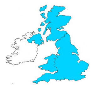
 IRELAND (in white) AND GREAT-BRITAIN (in purple)
 THE UNITED KINGDOM
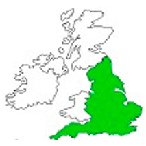
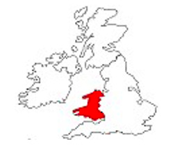
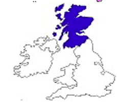
England is in green, Wales is in red, Scotland is in blue
 NORTHERN IRELAND is in yellow
RIGHT OR WRONG ? / Vrai ou faux ? Write the correct information in your English notebook.
Ecrivez les informations correctes dans votre cahier d’anglais.
1 Ireland and Great- Britain are continents.
2 Ireland and Great-Britain are islands (or isles)
3 There are 3 parts in Great-Britain
4 There are 3 parts in the United Kingdom
5 England is a large part of Great-Britain.
6 Northern Ireland is part of Great-Britain
7 Wales is part of Ireland.
8 Scotland is part of Great-Britain.
9 Great-Britain is an island /isle.
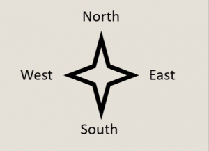
10 Scotland is North of Great-Britain.
11 Ireland is West of Great-Britain
12 Ireland is smaller than Great-Britain.
Key
RIGHT OR WRONG ? / Vrai ou faux ? Les informations correctes doivent figurer dans votre cahier d’anglais. Vous trouverez ci-dessous des jeux pour mémoriser les cartes.
1 Ireland and Great- Britain are continents. WRONG
2 Ireland and Great-Britain are islands (or isles) RIGHT
3 There are 3 parts in Great-Britain RIGHT
4 There are 3 parts in the United Kingdom WRONG
5 England is a large part of Great-Britain.
6 Northern Ireland is part of Great-Britain WRONG
7 Wales is part of Ireland. WRONG
8 Scotland is part of Great-Britain.
9 Great-Britain is an island /isle.
10 Scotland is North of Great-Britain.
11 Ireland is West of Great-Britain
12 Great- Britain is larger than Ireland RIGHT / Ireland is smaller than Great-Britain RIGHT.
GAMES